Harris Road and Highway 7 Changes
BC Transportation shows they are really the department "moving cars quickly to the expense of everyone else".
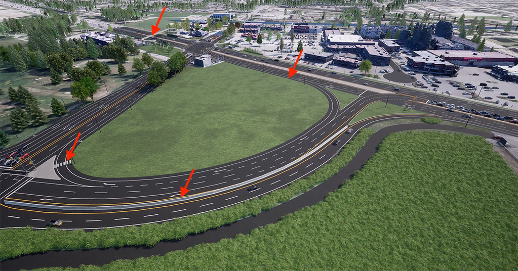
BC Transportation released this image of upgrades in the Pitt Meadows area of Harris Road and BC Highway #7 and asked for feedback. So here's my feedback.
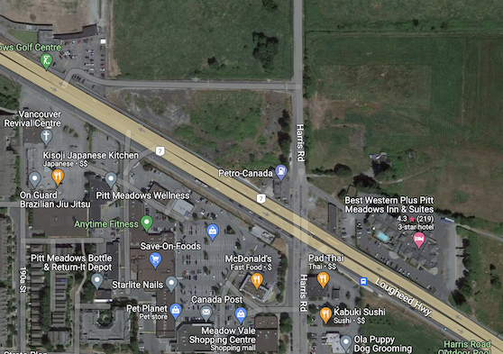
Currently it looks like this:
And here's the proposal (with arrows I added):
The speed limit on Highway 7 is 80km/h, so given the lack of automated enforcement of speed limits, we can easily predict that's at least 90km/h to 100km/h.
What's this trying to do?
It sounds like its trying to shift traffic from one intersection (the traffic light in the top left of the picture) to the new choices. But I can't spot any suggestion that it will actually limit the ability of traffic to turn left or right at the original intersection.
So in this case a car travelling west will go past the traffic lights, then turn right and double back on itself to get to another set of traffic lights. I'm not sure that will work as planned.
Crosswalk of doom
In the bottom left hand corner
The crosswalk goes across a slip road, designed to let cars go as fast possible around that corner. It has no lights to stop cars or other traffic calming at all. It goes to an island with no visible barriers or protections. The other end is a green space with no sidewalk or protection at all.
This crosswalk goes nowhere, offers no protection and is just designed to let drivers speed.
Barriers to protect car drivers, but no-one else
In the bottom middle
People in metal boxes driving fast get protection from each other. But no one else gets any protection at all. Pedestrians, cyclists, everyone else who get injured and killed in ever growing numbers in British Columbia get no protection. Yet again, what does this barrier placement show you?
Bike lane of terror
In the top middle
Yep, with cars going by at over 80km/h cyclists get protection with a peice of paint. Car drivers get more protection. I think that's a bike lane anyways, if you look at it on Google Maps and are travelling from east to west, that's all you get - paint.
On the south side there is a multi-user path that travels for a couple of blocks, with a stop for crossing the six lane road.
Pedestrian infrastructure is car infrastructure
In the top left
Want to cross the street, you've got a good long walk as you circle around and then over a bridge and then circle down again. This is classic prioritising the cars over everyone else. So people walking have to go long ways out of their ways to ensure that drivers can get to really fast all the time.
Safety of people other than car drivers not a priority
In project benefits they state:
Increase safety for drivers by shifting northbound and eastbound left turns to alternate locations with more capacity to reduce the likelihood of incidents at the intersection
They do not state that safety of people outside of cars is a priority.
See the press release here and give feedback here.