Strava all the things
Governments use Strava data, by recording your trips you help advocate.
Strava 1 is an app to record your exercise, your rides, runs, walks, hikes, workouts whatever. It has a whole pile of data about where you ride or walk - if you chose to do so.
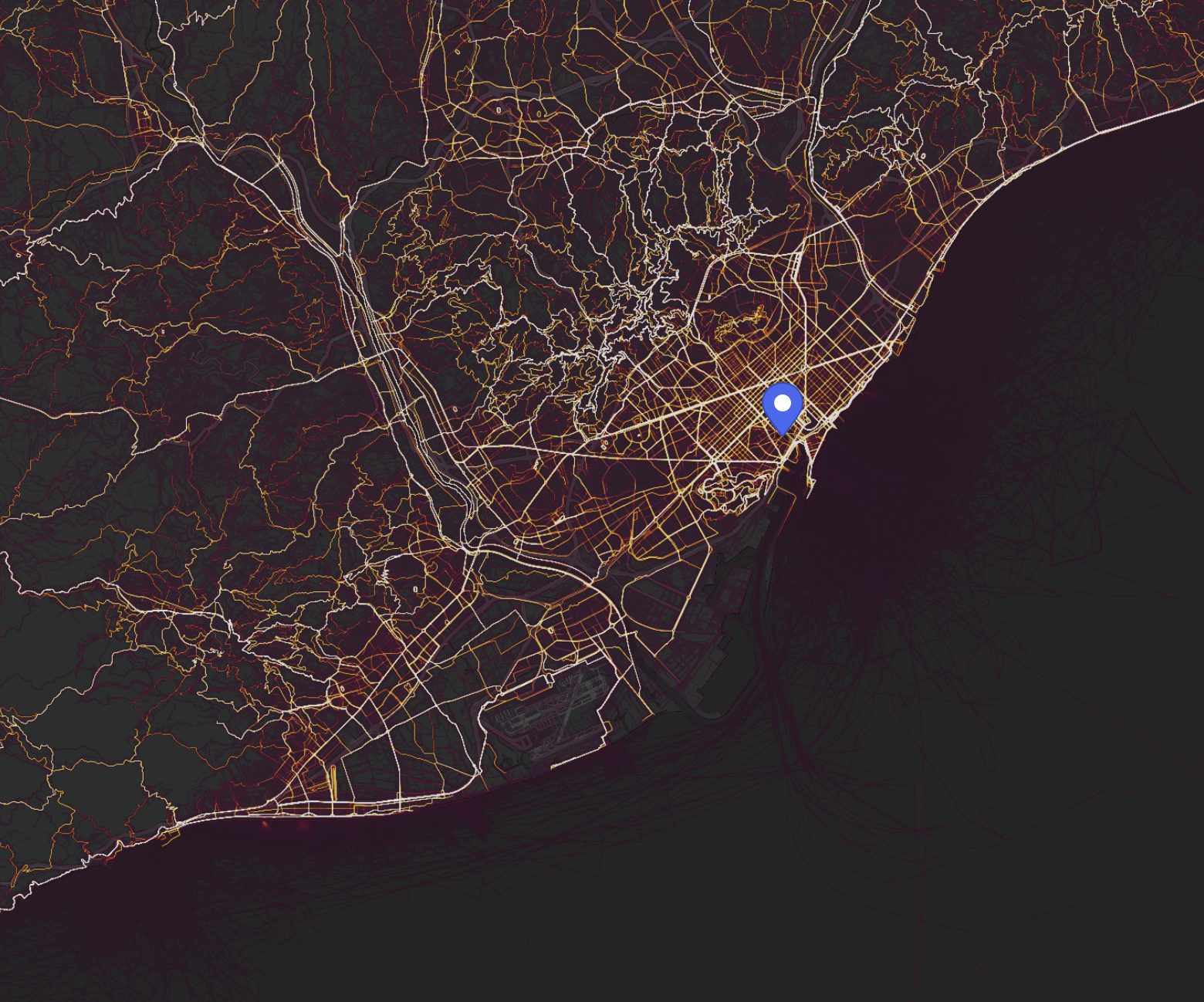
In the past I used to use Strava for my long rides and hikes, for training purposes. But these days, I'm starting to use it for every little ride, walk and so on. Why? Because it records that data and governments use it. Here's the heatmap for Barcelona:

What you can see here is the anonymized and aggregated data for all the activities in Barcelona.
So when a municipal government wants to understand existing usage patterns for cyclists or runners? You can ask Strava.
The Strava dataset is the largest collection of human-powered transport information in the world. Metro aggregates, de-identifies and contextualizes this dataset to help make communities better for anyone on foot or on a bike. We work with urban planners, trail networks, city governments and safe-infrastructure advocates to understand mobility patterns, identify opportunities for investment and evaluate the impact of infrastructure changes – all completely free of charge.
This is a hugely powerful resource available to city planners.
So I'm going to record every time I bike to a local store. Every time I walk to the gym. Every time I walk to a school. Because one day if a planner needs data to justify a choice beyond cars, I want the data to be there.
There's one downside to this, sadly it doesn't provide any data about intent. For example, if a road is so fast and dangerous people don't ride there, the Strava data won't be present. This doesn't solve everything.
There's at least one amusing consequence of this - exposing military bases - time for military personnel to brush up on privacy and security.
-
Strava is the app I use and it's the data I've seen used in presentations by municipal governemtns. ↩